
Ro-Weather Christmas Report
This is our weather report for the UK for this upcoming week. We will explore the details on Christmas day and chances of a white Christmas, also we will dive into this all of this week and see how the weather is changing towards Christmas day.
White Christmas?
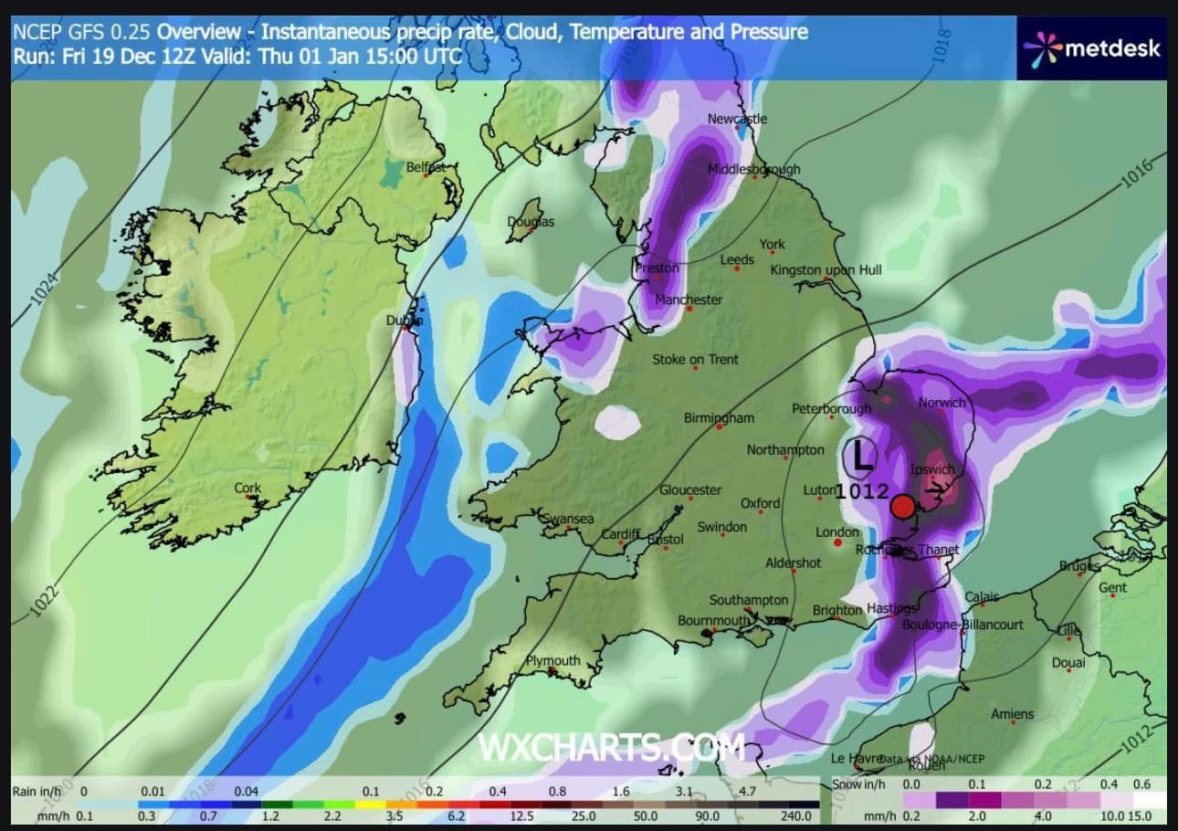
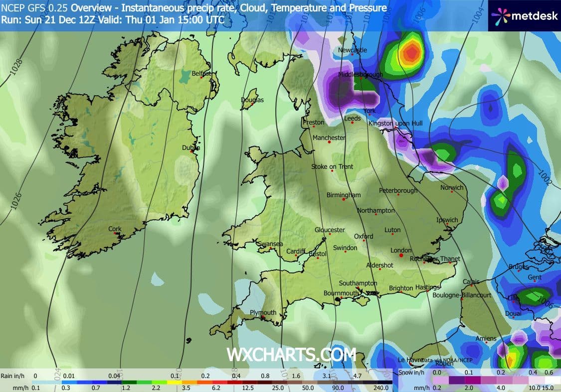
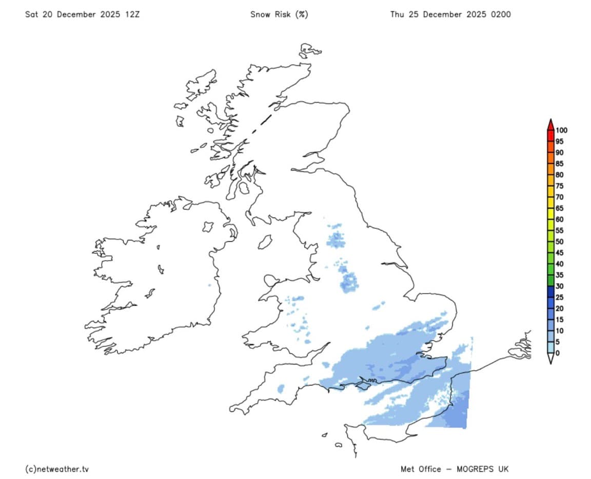
In these last couple days, our GFS models were showing an area of low pressure in the South East as seen on Map A. Plus also they were showing snow precipitation. But our latest models are showing a drier South East and small amounts of snow or freezing rain in Northern England (Map B). We still are not fully sure so keep an eye out for updates.
Update: Unfortunatly our latest models are shwoing a 10-15% chance of snow, but it is not much, still it is not clear what will happen.
Christmas Day
Staying clear for most in the South all day, lows of 0°C and highs of 4°C. In the North however it is staying mostly cloudy in the morning, in the afternoon partly cloudy conditions expected until midnight.
The Week Ahead
- Tomorrow: Overcast for most of the UK but staying dry as high pressure takes over with lows of 7°C and highs of 10°C.
- Tuesday: Will stay dry and overcast like Monday but is chiller with lows of 4°C and highs of 8°C.
- Christmas Eve: Cloudy start for most which clears up in the afternoon with partly cloudy conditions expected across the UK.
- Christmas: Clear for most all day, lows of 0°C and highs of 4°C.
- Boxing Day: Staying partly cloudy for most all day, lows of 5°C and highs of 7°C.